Crossing the heart of the Maiella National Park, the “Sentiero del Parco” is the king of the long distance hiking trails in the national park, and maybe of the whole Abruzzo region. Starting in Popoli, and ending at the train station of Palena, the trail climbs the main peaks of the Maiella mountain, and crosses villages of historical relevance like Caramanico Terme.
The trail is officially divided in four stages:
1) Popoli to Caramanico Terme
2) Caramanico Terme to Rifugio Pomilio
3) Rifugio Pomilio to Bivacco Pelino
4) Bivacco Pelino to Palena Station
The trail is only 83 km / 51 miles long, but it climbs Monte Morrone, Monte Amaro (the highest peak of the Maiella massif), and Monte Porrara, with a total ascent of 4250 meters / 13943 feet, and a total descent of 2750 meters / 9022 feet. On average, hikers should expect a 1000 meters / 3280 feet of climbing per day, however most climbing is packed into the first three days, and all descent is packed into the first and last day. So, be prepared for long days climbing and descending on narrow, although very scenic, mountain trails.
Lodging may be a bit of an issue for this trail. While Caramanico has plenty of hotels, small pensions, and private accommodations available, the Rifugio Pomilio (a mountain hut) has only 20 beds, therefore requiring booking your stay in advance, especially during high season. Nearby the Pomilio hut, close to the skiing resort of Passolanciano-Majelletta, there are other hotels that may have available lodging in case the Pomilio is fully booked, but walking to and from them adds distance and ascent to your hike.
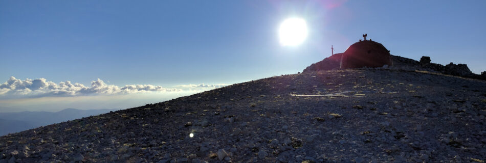
The most challenging place to find an accommodation is at the Bivacco Pelino, a mountain bivouac on the very top of Monte Amaro. The bivouac is open all year long, and it is free to use, but has no water nor food available, and only 10 beds. The beds, moreover, are just frame and wooden planks, so hikers planning to spend a night here will need not only to carry water and food, but also sleeping bags and mats to make their stay comfortable. And at 2793 meters / 9163 feet of elevation, temperature may drop below freezing even during summer, so your night kit must be up to the task.
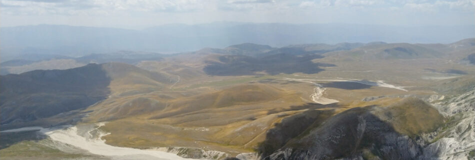
The trail crosses beautiful villages, rivers, and valleys, but mountains are the core part of it. And although lodging can be found in all seasons along the trail, snow may still linger on Morrone, Maiella, and Porrara during late spring. It is therefore advisable to only attempt this trail during summer, from June to September, and always check the weather forecast and all official information from the park. It is also important to know that this is not a circular trail, so you will need to organize transport to the starting point in Popoli, and, more importantly, from the ending point near the station of Palena.
The station of Palena is only served by a tourist train available in a few, selected, dates and must be booked in advance. So it is better to organize your way back from Palena’s station with another mean of transportation, like a car or taxi, or take a bus in the town of Palena. If you want to reach Palena by walking, the town is 10 km / 6 miles from the station, and this will add other 2 hours to your final day.
The official website (linked below) offers various information on how to plan your trip, including tracks in KML format. You may want to convert the tracks into GPX before loading them into your watch for navigation.
Official website: parcomaiella.it